
Soon after the War of 1812, increase in travel and business between the Connecticut Valley towns and Pittsfield and the west led to a demand for a better roads from Springfield. “Besides the Third Massachusetts Turnpike reaching Pittsfield by way of Northampton, Worthington and Peru, the most used road was the Hampden and Berkshire and Housatonic Turnpikes, chartered in 1826, reaching the same point by way of Blandford and Lee. Both of these routes traversed steep hills, and both were notorious for accidents to stagecoaches.” (Middlefield-Sternagle)
In 1818 a way was found through the Berkshires with easy grades called the “Pass of the Westfield” at the northern end of Mt. Gobble in Chester, where the three counties of Berkshire, Hampden, and Hampshire meet. A survey of this route for a railroad was made, but it was entirely preliminary, so the building of the Pontoosuc Turnpike began.
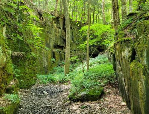
The Eighth Turnpike of Massachusetts aka The Pontoosuc opened up travel through wild wilderness, you hike some of this at the Keystone Arch Bridges Trail. Toll booths were constructed charging 10c per cart, 3c per sheep to pay for the road, tolls varied by the section. The old road still exists in most sections today in Becket and Middlefield, where the railroad didn’t build over it, stone lined with cellar holes where folks conveniently lived along it where mail coach would come through.
#hikethehilltownhistory
#hikethehilltowns with the #westernmasshilltownhikers #discoverthehilltowns #visitthehills #hilltownhistory #flashhike #intheberkshires #nature #adventure #history #hiking #outdooradventures #visittheberkshires #mylocalMA #visitma #hilltownhikers
Visit our blog for all of our adventures! We are on Instagram TikTok Pinterest Twitter YouTube Meetup @hilltownhikers
become a member at www.hilltownhikers.com
A 501c3 Massachusetts Non-Profit Organization


Leave a Reply