
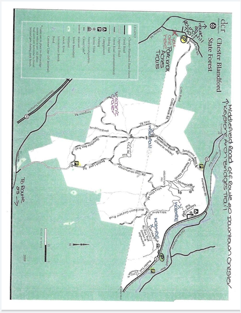
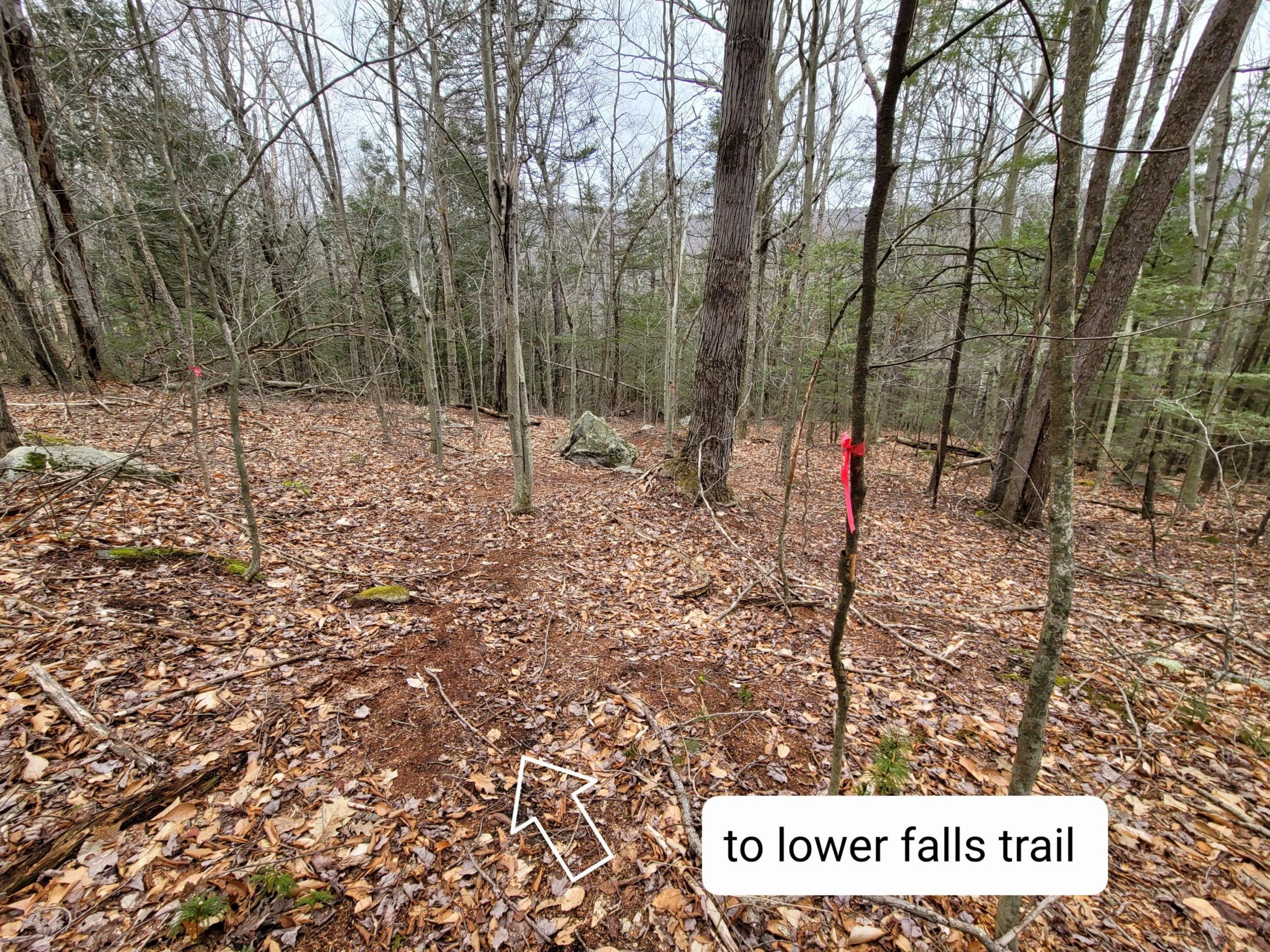
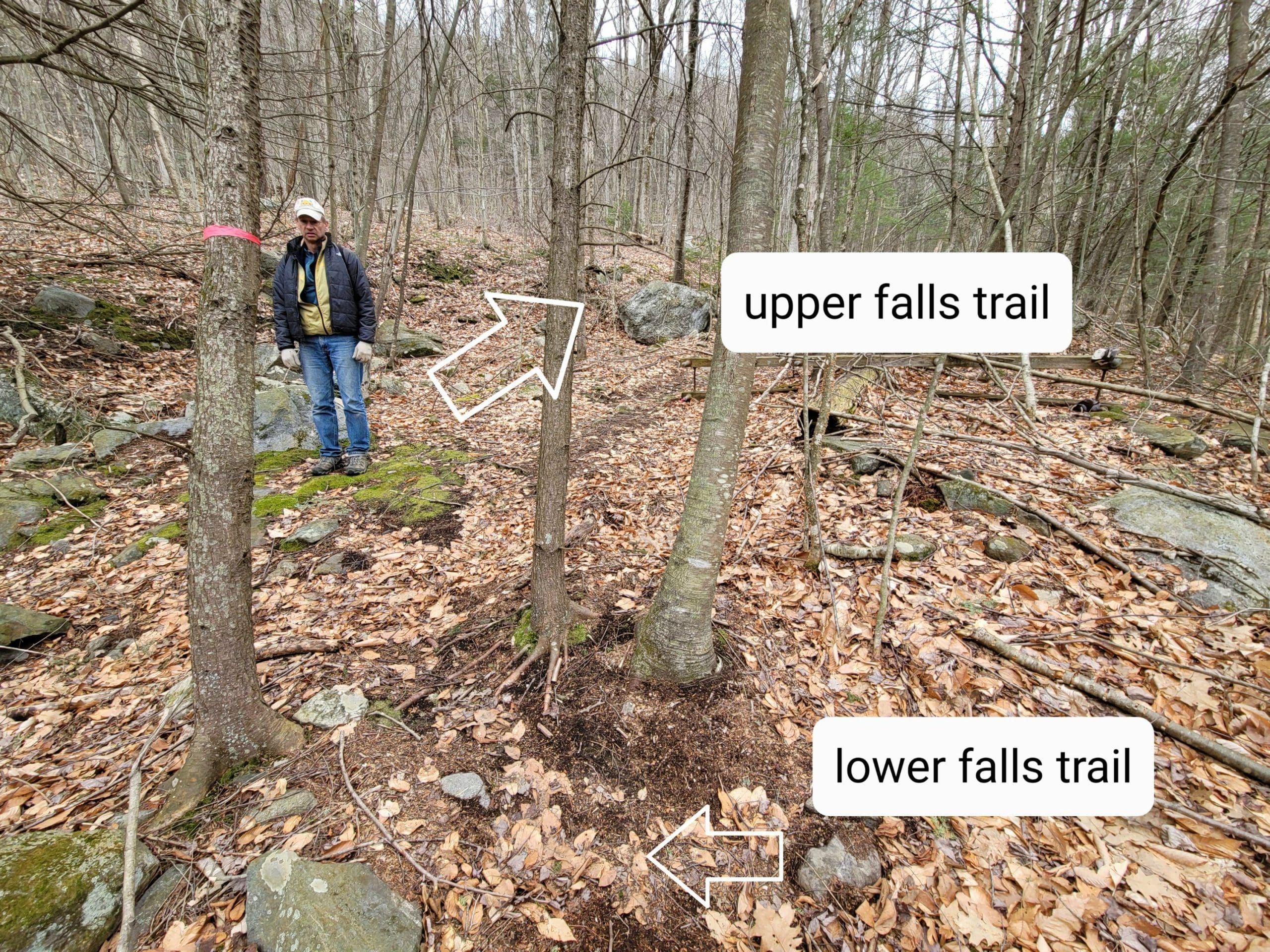
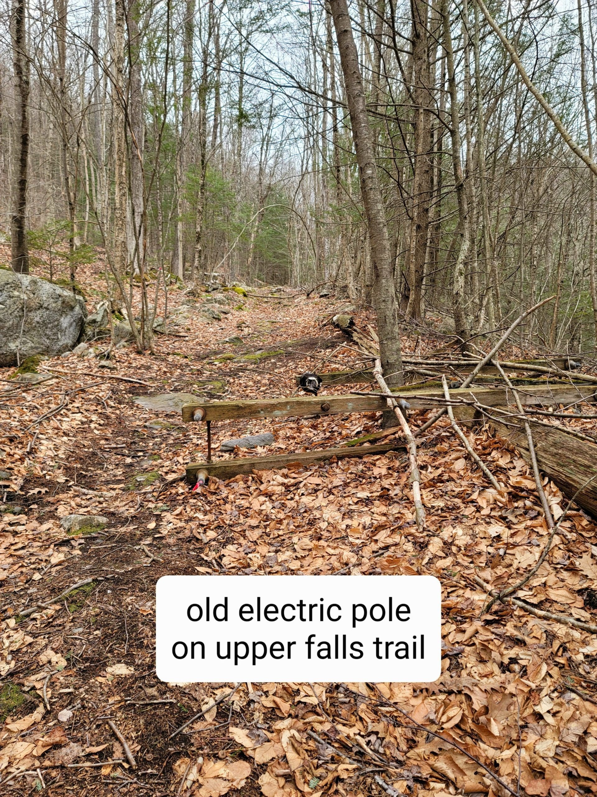
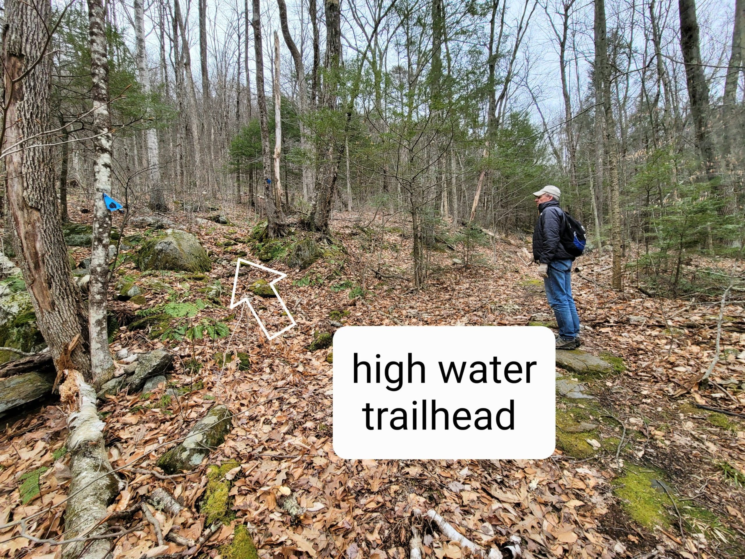
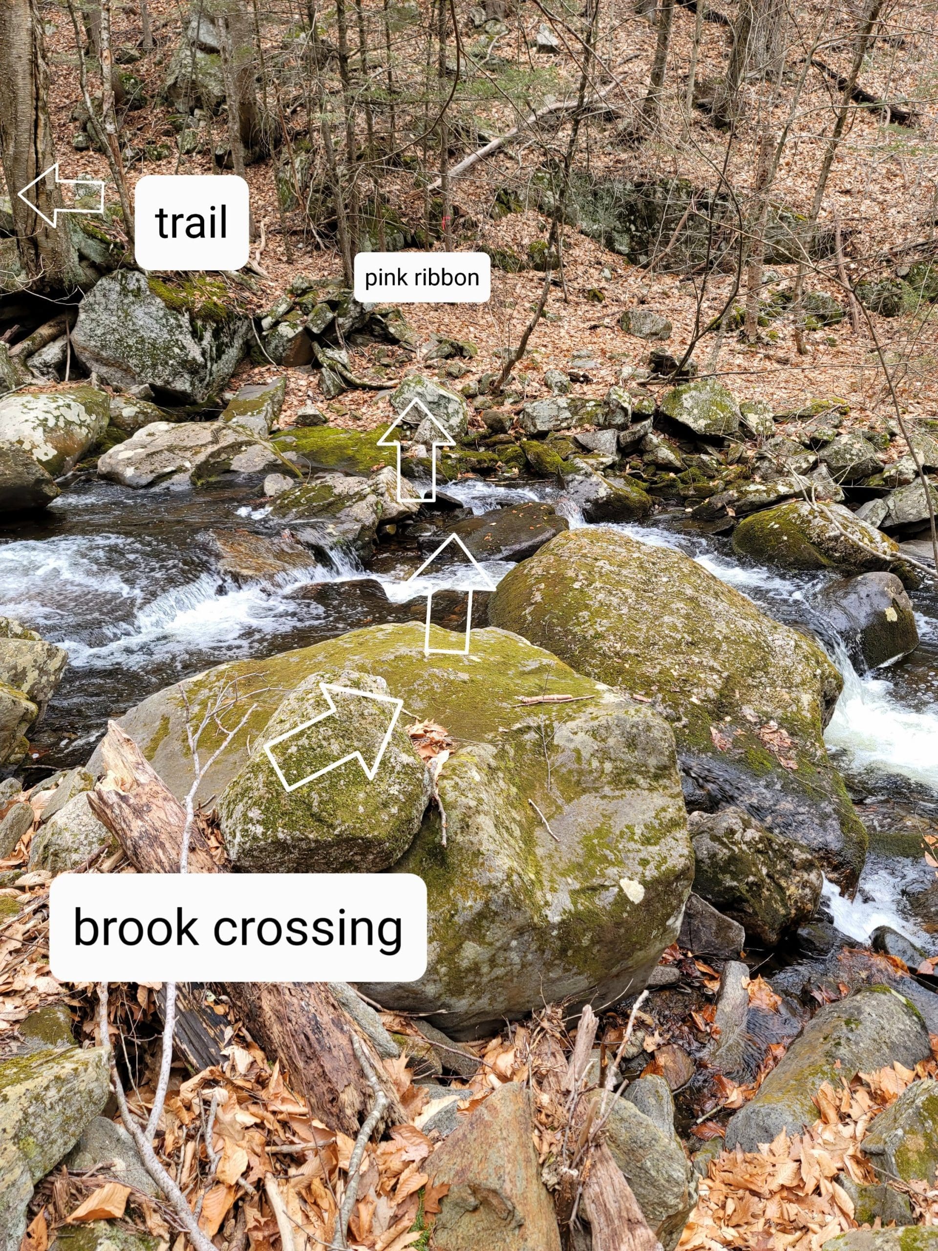
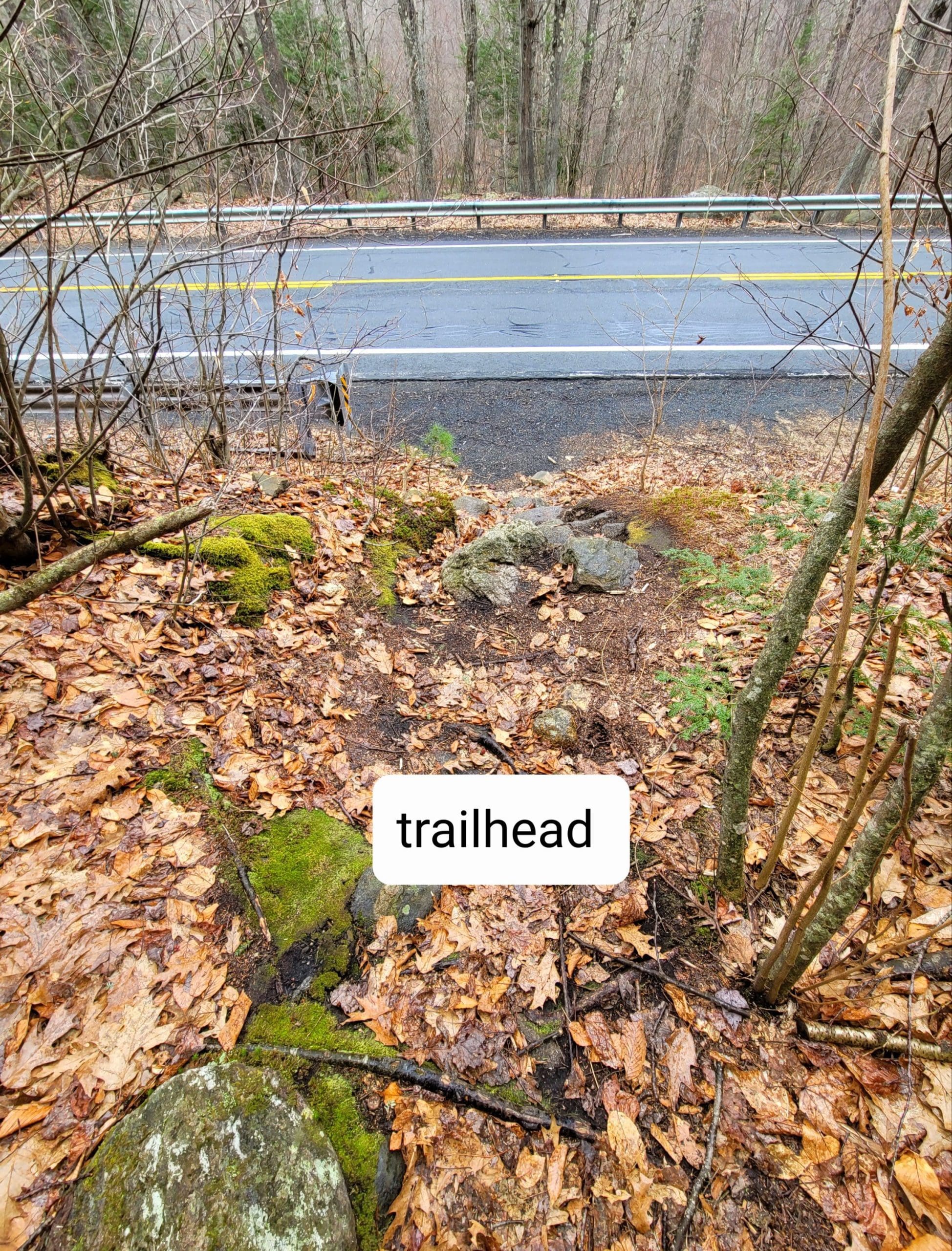
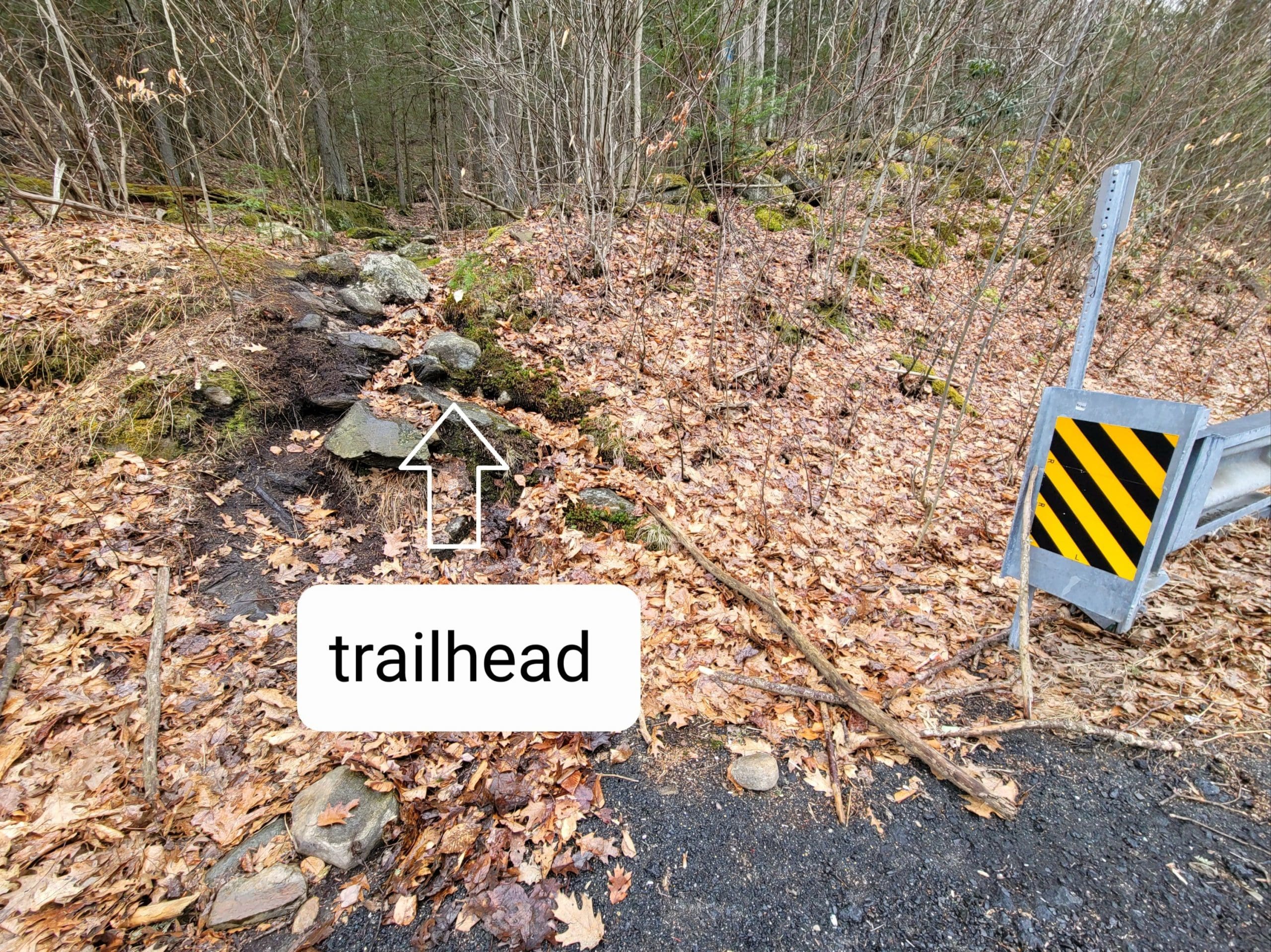
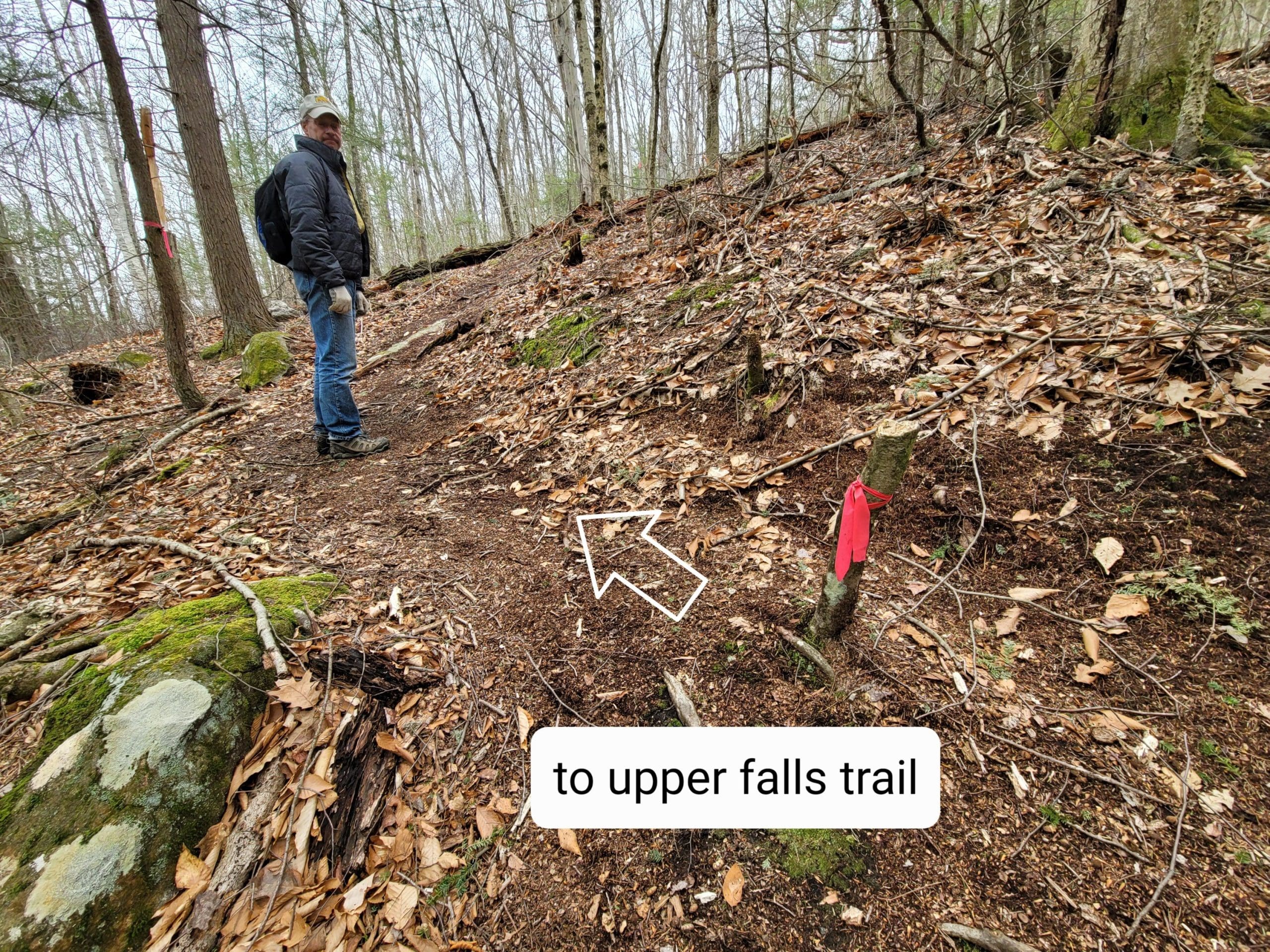
Goldmine Falls how to….in Chester, part of the Chester Blandford State Forest, after following the lower trail along the falls from Route 20 at the guardrail, (parking just across), the trail continues to the left (pink ribbon) connecting to the original DCR trail, stone lined either side, This originally started from the DCR Headquarters building on Route 20. Just past the downed old power pole the trail continues and eventually crosses Goldmine Brook at the washed out bridge, the stone embankments are obvious here, cross over two CCC Built stone culverts, continue on and reach Mica Mine Road and Observation Hill. Also at the downed pole, find the high water trail on your left, blue plastic marker, to take you high above Goldmine Brook and ending at Mica Mine Road. There is a cellar hole at the end, also Unkamit’s Path section #5 passes thru here. Mica Mine Road continues thru the State Forest. #chesterma


hikethehilltowns with the #westernmasshilltownhikers #discoverthehilltowns #visitthehills #hilltownhistory #flashhike #intheberkshires #nature #adventure #history #hiking #outdooradventures
Visit our blog for all of our adventures! We are on Instagram TikTok Pinterest Twitter YouTube Meetup @hilltownhikers www.hilltownhikers.com
A 501c3 Massachusetts Non-Profit Organization Donate here on Square https://hilltownhikers.square.site/


Leave a Reply