

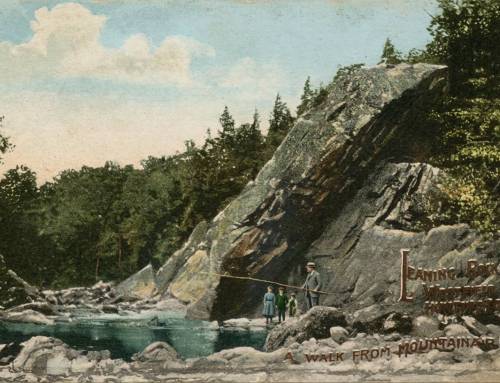
Leaning Rock 50 feet high, left in place during the creation of Knightville Dam in Huntington.
The Knightville Dam Recreation Area encompasses 2,430 acres of land that is overseen by the U. S. Army Corps of Engineers. The dam was constructed from 1939-1941 impounding the North Branch of the Westfield River. Its creation was in direct response to the devastating flood of 1936.
Off route 112 turn onto Knightville Dam Road.
Walk over to the long chain-linked fence that separates the picnic area from the steep slope leading down to the river. Look for a small opened gate where two sections of the fence come together at a right angle. Follow a fairly steep path that leads around and down to the river and to the base Leaning Rock in 100 feet. Courtesy of Christy Butler, find this and more in his book “Rockachusetts” #hikethehilltowns with the #westernmasshilltownhikers


Leave a Reply