
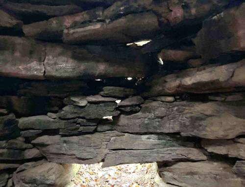
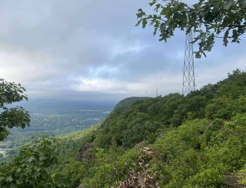
Part 2. Provin Mountain to Robinson State Park with views of Springfield and Hartford, past Provin Mountain reservoir. On the NET Section 2 from Route 57 in Southwick thru Agawam and Westfield. Starting at the quarry to the tri town boundary stone to the cliffs looking over the valley plain as far as the gateway to the Hilltowns and Tekoa Mountain, Russell windturbines and farthest Round Top Hill highest elevation in the Pioneer Valley. Four miles thru one way. Great hiking across the ridge!
The New England National Scenic Trail (NET) is a 235-mile hiking trail route that has been in existence for over half a century. The NET travels through 41 communities in Connecticut and Massachusetts, and is comprised primarily of the historic Mattabesett, Metacomet, and Monadnock (M-M-M) Trail systems.
Western Mass Hilltown Hikers
#hikethehilltownhistory
#hikethehilltowns with the #westernmasshilltownhikers #discoverthehilltowns #visitthehills #hilltownhistory #flashhike #intheberkshires #nature #adventure #history #hiking #outdooradventures #visittheberkshires #mylocalMA #visitma #hilltownhikers #westernmass #hikingwithdogs
Visit our blog for all of our adventures! want to come along on these hikes? Become a member at www.hilltownhikers.com
Help conserve the Chester Granite Saw, our newest property! https://www.pledge.to/help-conserve-the-chester-granite-saw
Text HILLTOWNHIKERS to 707070 to donate.
www.hilltownhikers.com
You can mail your tax-deductible donation to Western Mass Hilltown Hikers, PO Box 3, Chester, MA 01011
Venmo @hilltownhikers
Stay informed – join our mailing list https://lp.constantcontactpages.com/sl/5O0RYN5/hilltownhikeremail


Leave a Reply