


Jug End was once a Ski Resort! Check out this great web site for more info
Jug End Barn (nelsap.org)
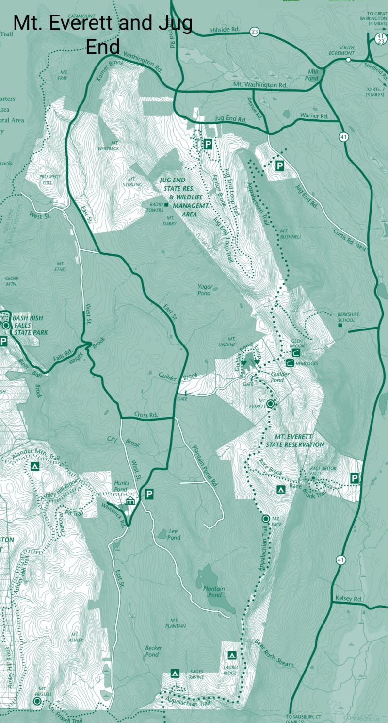
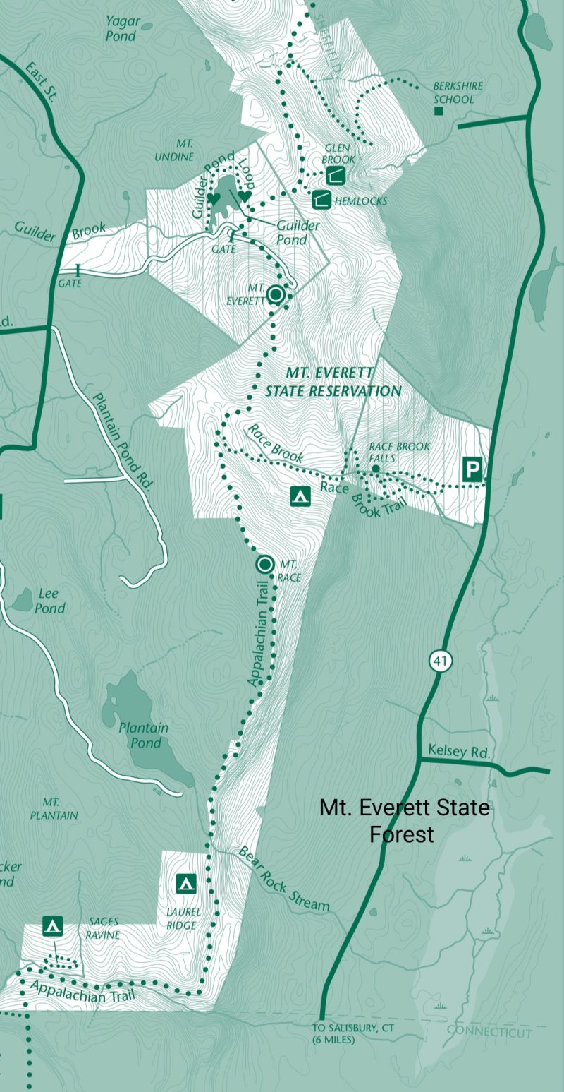
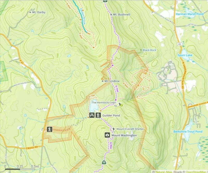
Guilder Pond to Jug End Hike
Length: 7.5 miles Difficulty: Moderate to Strenuous Time: 5.0 hours Route type: Out and back GPS: 42.103508, -73.452774 Publication Date: 10/26/2011 Author: Daniela Wagstaff
Directions to trailhead
Turn left on Cross Street. Make the first left on East Street and continue ½ mile to the Mount Everett State Reservation park entrance on the right.
Hike Description
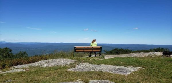
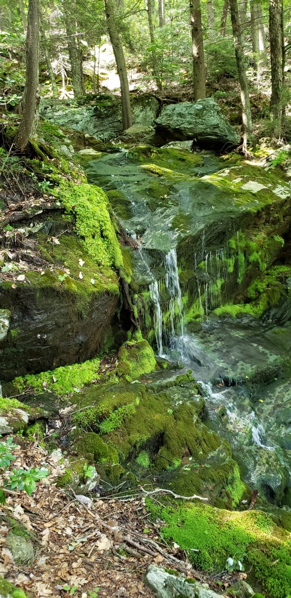
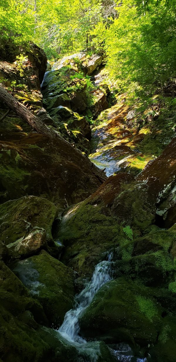
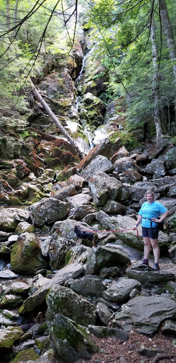
Depending on when you do this hike, you may drive into Mount Everett State Reservation to find the gates open or closed to traffic. The gates are generally open in the summer during the day (closed at night) so people can drive all the way up to the picnic areas at Guilder Pond but at the time of this writing, October 2011, the gates were closed due to severe erosion of the road, damage resulting from Hurricane Irene. Although this prevents cars from driving through, foot traffic is allowed and there is plenty of stable surface to walk on. Ample parking spaces are available before the gates so park your car and begin the hike by following the packed gravel road beyond the gates. Even if the gates are open you might want to park here, as it’s a lovely .65-mile hike up the gravel road.The road ascends through lush forests, never very steeply but enough to get your blood pumping. As you enter a hemlock grove, sounds of a small waterfall in the woods to your left will indicate you are nearing Guilder Pond. At the .65 mile point, turn left at the sign for the Guilder Pond Trail. The trail will be blazed in blue. Sometimes turns are indicated by the direction of the point of a blue triangle, other times by the double rectangle blazes. This inconsistent blazing is typical of the blue-blazed trails in this area.Almost immediately cross a creek, the source of the waterfalls heard just a few minutes earlier, on a split log footbridge. A picnic table on the right might beckon you to take a break but there will be spots with better pond views along the way. Continue to follow the trail as it alternately skirts the pond then veers into the hemlock forest and back. At the 1.20-mile point, start watching for unmarked side trails to the right that will bring you to a large rock ledge overlooking the entire pond. Now this is a break spot!In another .10 mile you will run into the Appalachian Trail. Turn left here to follow the white blazes all the way to Jug End. To the right, the blue-blazed Guilder Pond Trail joins with the white-blazed Appalachian Trail for a tenth of a mile before the two split apart in the upper parking lot, the destination of cars if the park gates were open. A composting toilet is located in this parking lot.Continuing north on the Appalachian Trail, in a quarter of a mile pass a sign for the Hemlocks Shelter, rock hop over a creek, then after a few more step be sure to continue following the white blazes as a blue-blazed side trail leads to the Glen Brook Shelter.In about .75 mile keep left on the AT and rock hop over a creek as the blue-blazed Elbow Trail goes right. The Elbow Trail terminates at the Berkshire School on MA Route 41.In another half mile you might be tempted to leave the trail to the right, following faint unofficial paths in search of views but resist the urge as there is no need to trample the vegetation as others have done. Before you know it, the Appalachian Trail will deposit you directly on to a rock outcrop at the summit of Mount Bushnell for unobstructed views of the Massachusetts countryside. Look towards the horizon for the highest peak, Mount Greylock, the highest mountain in Massachusetts, about 40 miles away.Where the trail ascended and descended along a fairly smooth trail up to this point, you will now find the path becomes more rugged with steeper inclines and some short rock scrambles. There will be more views to your right as you continue on, especially during times of no foliage, while traveling along the ridge. At the 4.4-mile point, a large cairn indicates you have reached Jug End but continue on briefly, stopping before the trail drops precipitously, to enjoy the views. Turn around and head back the way you came. Continue straight when the Guilder Pond Trail joins the AT on the boardwalk resulting in white and blue blazes the rest of the way to the upper parking lot. Walk past the composting toilet then turn right and follow the gravel road .85 mile downhill to your car.Click here for more pictures of this hike and for a 9.3-mile version combining this hike with a hike to Mount Everett.
Turn-by-Turn Description
[ 0.00] From parking area before gate, walk beyond gate and follow the gravel road[ 0.65] Turn left on blue-blazed Guilder Pond Trail[ 1.20] Unmarked side trail to right to rock outcrop with pond view[ 1.35] Turn left on the boardwalk on the white-blazed Appalachian Trail[ 1.60] Keep straight on the AT at the Hemlocks Shelter sign, rock hop over creek, straight on AT when blue-blazed trail goes right to Glen Brook shelter[ 2.20] Rock hop over small creek[ 2.35] Keep left on AT when blue-blazed Elbow Trail goes straight, rock hop over creek[ 2.90] View at summit of Mount Bushnell[ 3.85] Rock cairn at Jug End, continue briefly to views; retrace steps[ 6.35] Keep straight on AT on boardwalk when Guilder Pond Trail goes right[ 6.65] Walk past composting toilet, turn right and follow gravel road downhill[ 7.50] Back at parking lot


Bash Bish Falls from the Massachusetts Side
Bash Bish Falls from the Massachusetts side, parking on Falls [...]

Bash Bish Falls from the New York side
Bash Bish Falls from the New York side, parking on [...]

Alander Mountain in Mount Washington
Alander Mountain in Mount Washington(town) hiked up from Mount Washington [...]

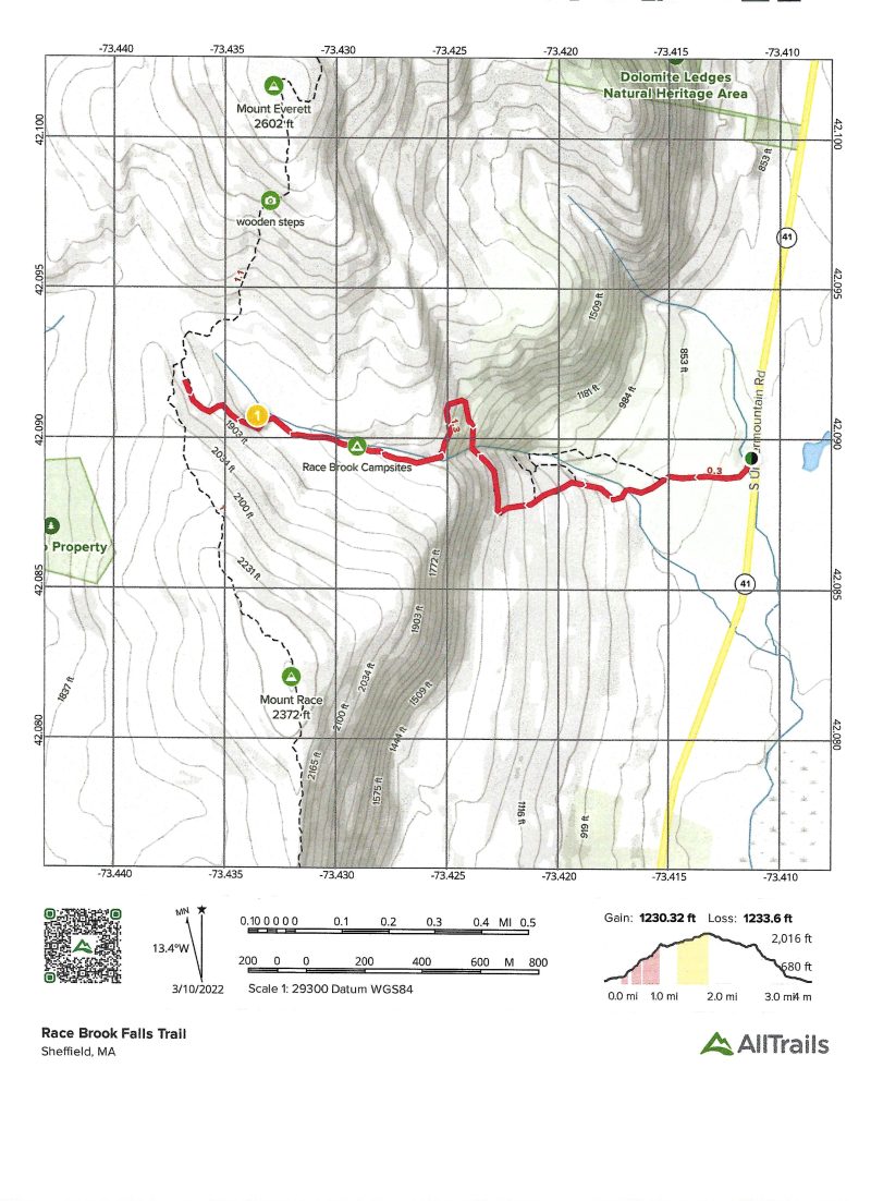
Mt Everett in Mount Washington
Mt. Everett from Mt. Everett State Forest parking on West [...]


