

https://m.facebook.com/groups/390996991007497/permalink/3496126787161153/?sfnsn=mo
The Henhawk Trail Homesteads
The Walling map of 1856 and the Beers map of 1873 show Nash Hill Road and the Henhawk Trail and the owners of homes along them in or just before those years.
At bottom left, a line connecting the black dots representing the houses of John Crowell Williams and Prescott Williams would approximate the present-day Ice Road. At right center on the 1856 map, a line running eastward from the road just above the home of Isaac “Demon” (Damon) would approximate the present-day continuation of Nash Hill Road toward West Whately. The road eastward that intersects the Henhawk Trail near the home of Caleb Graves (1789-1864) — formerly of his father Elihu Graves (1750-1815) — is long since discontinued, though it’s still a nice walk and is used by snowmobilers. The very large Graves cellarhole on its north side is farther from the Henhawk Trail than the map indicates — maybe 100-150 yards — and close beside a brook that provided the family with water. The shared home of brothers Norman and Hiram Graves (Caleb’s sons and Elihu’s grandsons) was much closer to the intersection of that old road with the Henhawk than the map shows. It appears in the right place on the 1873 map. Hiram stayed on that farm for 14-15 years after Norman left it about 1870, and then he moved away. The 1873 map of Williamsburg shows him as the owner of both that house and the one his father and grandfather had lived in. Sometime after Hiram left, the Lombello brothers bought the home and farm on the west side of the Henhawk.
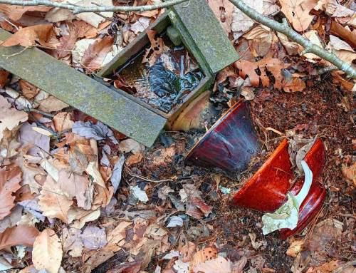
The Isaac Damon cellarhole and a small barn foundation remnant are still clearly visible just south of the intersection of the Henhawk Trail with Nash Hill Road. A sodden homesite that could never have been pleasant to live in, it was abandoned by 1873 and didn’t appear on the Beers map of that year. North of there, but south of the discontinued eastward connecting road, there are indistinct, fragmentary remains of the foundation of Samuel Nash’s (1766-1826) home in the embankment on the right side of the Henhawk Trail. That homesite has been largely obliterated, perhaps by road alterations or logging machinery.
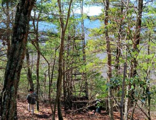
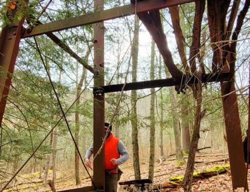
Up north on the east flank of High Ridge are the still clearly-defined cellarhole and extensive farmstead traces of the home of Revolutionary War veteran Capt. David Scott Jr. (1748-1812). Though they lived in Williamsburg, the Scotts evidently felt more closely connected with West Whately, which was a bit closer to their home than Burgy center, and they are buried in the West Whately Cemetery. Three generations of David Scott families lived on this farm until 1865, when David Scott IV and his brother John F. moved over to Poplar Hill in West Whately. The 1871 Beers Atlas of Franklin County showed their new home there, and the 1873 Beers map of Williamsburg didn’t show the old homestead on the Henhawk Trail at all. I take that to mean it was abandoned then, though it might mean the house had burned or otherwise been destroyed. But as late as 1906 and 1907, Town Meeting articles proposing the discontinuance of part of the Henhawk Trail as a public way still referenced “the old Scott place” as an identifiable landmark, and it remains one today.
Courtesy of Eric Weber


Leave a Reply