
One of the most popular destinations in the Hilltowns are waterfalls, of those we have plenty! Here are some of the most impressive and enchanting flowing brooks in the northern and southern hills.

Goldmine Falls in Chester, MA
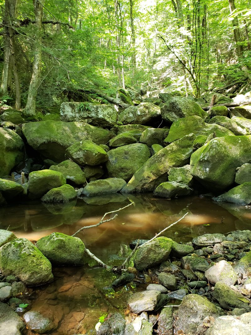
Both upper and lower Goldmine Falls are little gems which are actually very easy to reach being about only 100 yards from a main highway. Be assured that the effort to visit both of these falls is well worth it. These obscure waterfalls are usually visited infrequently and only by nature enthusiasts. On Route 20 in Chester between Sanderson Brook Falls and the DCR Ranger Headquarters building, there is a pull off parking area just across from the DCR sign. Once you park look across the the road to the guardrail, at the edge where the yellow and black caution stripes are is the trail entrance. Many hikers travel right by it without finding it, however if the speed limit on the State Highway was 30 mph it would be obvious as it travels under the road and empties into the Westfield River.
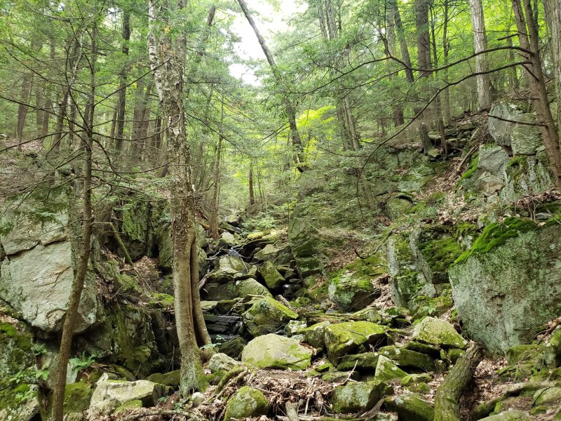
The first part of the falls is known as lower Goldmine Falls (closest to Route 20), climbing higher up the trail and veering to your left, the trail continues and meets up with the old original Goldmine Falls Trail. This originally started at the DCR headquarters building. There were once picnic tables and firepits there. At this junction you will see an old downed power line pole. About fifty feet or so on your left will be the High Water Trail entrance. This trail takes you very high above the falls in a forest full of giant hemlocks and meets up with Mica Mine Road. Back to continuing up the old stone lined trail, you will pass over CCC constructed stone bridge culverts amazing in size. The trail comes to an old washed out bridge with stone abutments. This is only passable in low water. The trail continues along Goldmine Brook until you reach the main trail, aka Mica Mine Road. There are giant culverts here. Take a right and head to the Mica Mine and further to Observation Hill Road and the Memorial and H. Newman Marsh Trail. See the Chester Blandford State Forest Map for details.


Sanderson Brook Falls in Chester
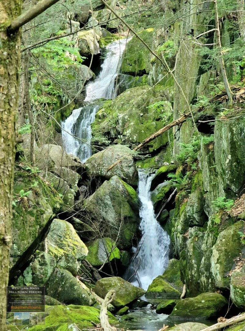
The most popular hike at the Chester-Blandford State Forest is to this particular falls which is pleasant and unique. It is relatively flat in the beginning and then starts to climb at a steady pace, going over several steel girder bridges as you hike alongside Sanderson Brook the entire way. Be on the lookout for the small sign on a tree guiding you to take the side trail on the right which takes you right to the bottom of the falls. During the driest months a sandy beach forms at the bottom of the falls which makes for epic photos. This is also a very popular waterfall and it seems you will always meet people coming and going. The Falls themselves are a long rambling cascade with a 25 foot drop at its top. The unique aspect to this waterfall is how the water from the top drop is redirected, spurting upward with a geyser like plume. Keep hiking along the main trail (Sanderson Brook Road) and you will come to the official vista where the trees have been cut and you get a view of the entire falls from a higher vantage point.

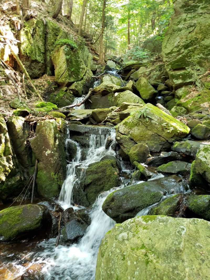
Glendale Falls in Middlefield
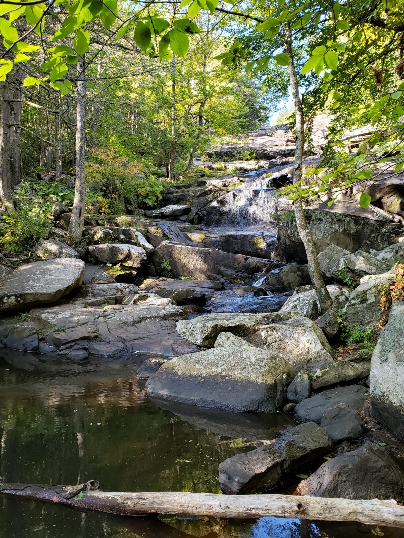
This waterfall is noted for overflowing its banks during the spring thaw but, later being reduced to a trickle during the summer months. Glendale Falls is essentially a series of cascading waterfalls strung together, several having 15-20 foot drops giving the viewer a variety of different encounters depending on the various water flow. You can only experience the entire waterfall by walking down to its bottom which can difficult to do during the months of Winter or early Spring due to ice and slippery hillside. As with most New England waterfall sites, old stone foundations of early industrial usage of the water power can seen at the top and across the stream. Evidence of sluice way and a hand laid stone foundations are here, although next to impossible to access during high water or high flow periods. Directions: From Peru center, follow Rt-143 east for 3.8 miles. Turn right onto River Road in West Worthington, follow this road for 5.5 miles and turn right onto Clark Wright Road. Go uphill for .4 of a mile, just before a small bridge you’ll notice the Trustees of the Reservation sign at the opening of a parking lot with room for several cars.


Windsor Jambs in Windsor
Windsor Jamb’s location is readily accessible via hiking from the lower camping and recreation area or by vehicle to a parking lot just a stone’s throw from the upper part of the jambs. However, access to the cascading rapids due to the sheer and steep rock gorge that the “jambs” flows through aptly earns its name. The height of the walls become higher as one proceedes downstream. A chain link fence follows the length on one side preventing those from falling. Although, another variant to its spelling refers to the “Jams” being unsuitable for logging due to the log jams created by the narrowing gorge.
Becket Ravine Falls in Becket
This location is just a stone throw from the center of North Becket. While many have called it “Becket Center Falls,” it is better known as the “Becket Ravine. ” While access is limited, the cascading falls are impressive and make getting down to the falls worth the effort.
Directions: to Becket Ravine From the center of Becket Village on Rt-8, take Brooker Hill Road up hill for .2 of a mile. A small pull-off for one car is located on the right side of the Road. Over the embankment of hemlocks you’ll see Mill/Morgan Brook below and the Becket Ravine. Some of the abutting land is posted so be wary of trespassing on those.


Otis Reservoir Falls. Tolland State Forest in Otis
The unique roar and display of Otis Reservoir Falls is readily observed during late fall and into the winter months. The waterfall source is the discharge from the Otis Reservoir above. In preparation of the winter freezing, the reservoir is drawn down until the Spring thaw when the discharge gate is closed and reservoir is refilled. Then the falls dry up. A startling contrast and reversed perception while other waterfalls are awaking with fresh winter run-off Directions: to Otis Reservoir
Located within Tolland State Forest these falls are easy to access and provide a thunderous show when flowing. From the center of Otis, travel 3 miles south on Rt-8, turn left onto Reservoir Road, travel 1.6 miles and turn right onto Tolland Road. Another .8 miles brings you to the Otis Reservior Dam. Park in small dirt pull off before dam. A small path leads one to the brink of the falls.

Shatterack Falls in Russell and Montgomery
All five waterfalls are located along an old cart path road, park at Russell Road in Montgomery at the barricade (road is closed in winter), walk in on Russell Road take the first left onto the cart path downhill all the way, hear the brook on your left. 2.5 miles one way. This is also in Christy Butler’s book Berkshire Destinations look for it on Amazon it has some great adventures in it complete with maps and gps!


